 I have to admit, I’m
 a bit terrified of deep sea creatures. I mean, 95% of the ocean floor remains unexplored. That is A LOT of room for giant squid to roam. Lucky for me, NOAA decided to explore the waters off of Puerto Rico in search of the deep sea life that haunts my dreams.
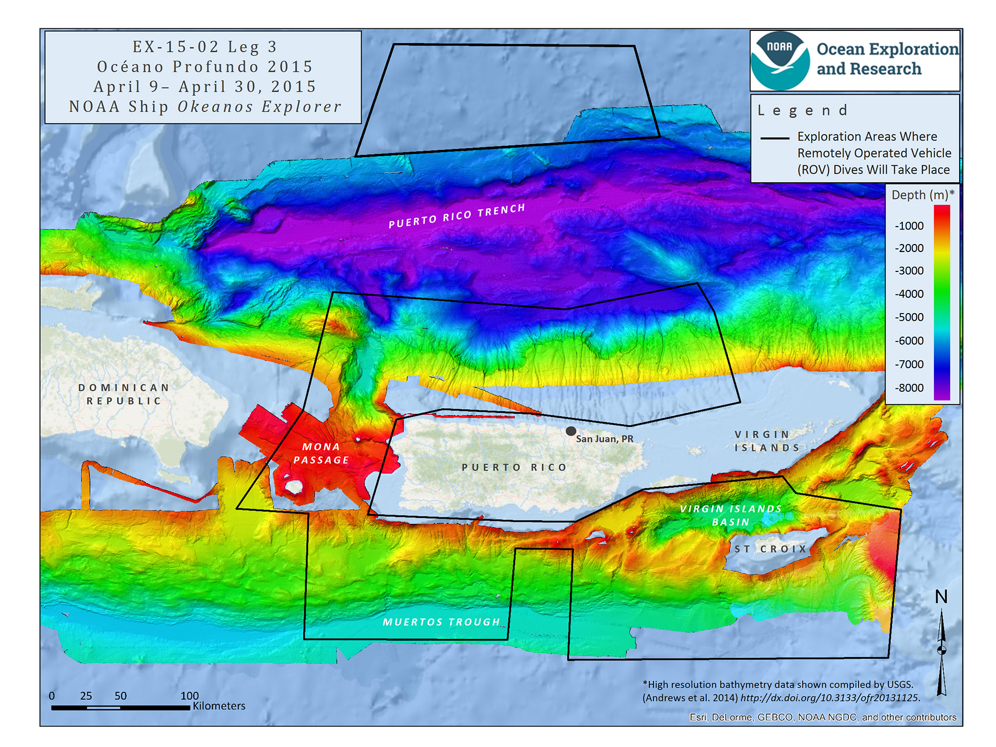
From April 9 to April 30, 2015, NOAA Ship Okeanos Explorer explored largely uncharted deep-sea ecosystems and seafloor in the vicinity of Puerto Rico and the U.S. Virgin Islands. What they found – using state of the art technology – will amaze you!
Quartz posted this incredible video to their Facebook page, using footage gathered from NOAA. Some of these creatures are so new – they don’t even have names.
Océano Profundo 2015
Legs 1 and 2 of the mission focused on mapping the seafloor where primarily only low-resolution satellite or topographic data existed previously. Leg 3 of the expedition featured some of the deepest remotely operated vehicle (ROV) dives ever conducted in the region and collected critical deep-water environmental data that will improve ecosystem understanding and inform federal and local resource managers.
Why Puerto Rico?
According to NOAA, a diversity of seafloor features lie just offshore Puerto Rico and the U.S. Virgin Islands that include trenches, seamounts, numerous submarine canyons, valleys, and troughs. These features likely contain valuable and vulnerable ocean resources, but very little is known about them, making this an important area to survey.
It is crucial to explore this area for several reasons:
- It is tectonically active, with seismic hazards
- It includes a large section of U.S. Exclusive Economic Zone
- One of the major fisheries in the area is deepwater snapper, but little is known about snapper populations there
- It is of potential interest for marine protected area managers, those creating ocean usage planning maps, and sanctuary managers
Communication Technology
NOAA did a fantastic job of documenting their journey, allowing scientists and the public access to mission logs, daily reports, photos, video, and live underwater video feeds.
During the dives, Okeanos Explorer’s two-body ROV system continuously captured high-definition video, which the ship transmitted to the Office of Ocean Exploration and Research’s website, www.oceanexplorer.noaa.gov, where anyone could follow along in near-real time!

Okeanos Explorer
NOAA Ship Okeanos Explorer, “America’s Ship for Ocean Exploration,” is the only federally funded U.S. ship assigned to systematically explore our largely unknown ocean for the purpose of discovery and the advancement of knowledge. Telepresence, using real-time broadband satellite communications, connects the ship and its discoveries live with audiences ashore. Visit the NOAA Marine Operations Center Okeanos Explorer page for operations and crew information 🙂
